Overview
Satellite imagery provide high-resolution images to study the variations and conditions of crop fields, but prohibitive costs and low accessibility suggest that alternative imaging methods should be used. Currently, the use of Unmanned Aerial Systems (UASs), which is a form of Low Altitude Remote Sensing (LARS) systems, have presented a new area of study related to Precision Agriculture (PA). The most popular UASs are Unmanned Aerial Vehicles (UAVs), which are a means for inexpensive data gathering of high spatial and temporal resolution imagery i.e. the images are of good quality and are obtained daily. The images are crucial to initial PA procedures such as field mapping, which includes vegetation detection and row identification. The lack of row detection techniques for orchards from aerial images are attributed to the additional challenges present in orchard data. A modified Hough Transform with post-processing is applied to detect crop rows. However, the algorithm is altered for when orchard data is: (1) highly dense growth areas with overlapping between trees which causes poor initial tree separation and detection, and (2) plantation methods which introduce curved rows to suit the terrain. The algorithm is able to successfully detect rows which are clearly separate with moderate curvature.
Experimental Setup
The data used for this project comprises a selection of orchards with varying features. We tested the algorithm on three different orchard inputs with each input portraying a different based on a unique set of row and detection characteristics.
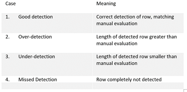
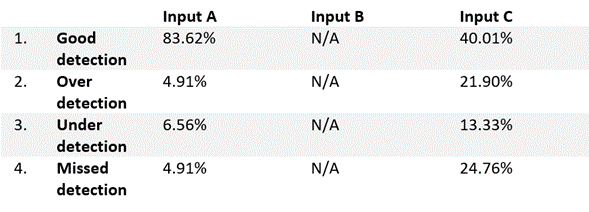
We show the performance of the proposed Modified Hough Transform on each of the orchard inputs. The results were caculated by comparing the model ouputs to hand-lablled rows and evaluated through precision and recall. The criteria with their respective definitions provided in the table below were used to evaluate the precision and recall of the results.
Experiments were conducted on an Acer laptop running Windows 10 x64. The machine has 8.0 GB of RAM and a four core intel Core i5 CPU with clock speeds of 2.30 GHz.
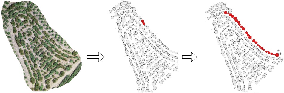
Performance results of proposed algorithm on orchard input A. Black edge = initial guess, red edge = Certain expansion, blue edge = uncertain expansion
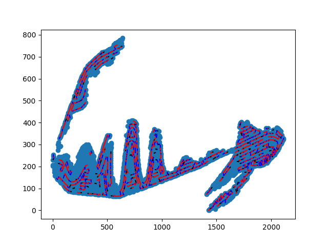
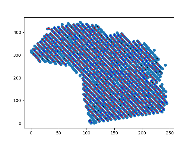
Performance results of proposed algorithm on orchard input C. Black edge = initial guess, red edge = Certain expansion, blue edge = uncertain expansion
Conclusion
In this paper, we test the robustness and accuracy of a modified Hough Transform on orchard row identification in aerial images. The crux of the algorithm lies in the post processing step which expands the identified row segements into full rows.
The method can reliably detect straight rows, rows of moderate curvature and even rows of quadratic curvature buts struggles with erratic row spacing.